Google Earth AI Feature Sparks Concerns Over Fake Satellite Images
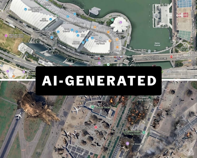
A new artificial intelligence feature on Google Earth recently caused concern after it allowed users to create and share fake satellite images. For a short period, the tool enabled anyone to generate realistic-looking maps of various locations, including areas in Singapore, which did not accurately reflect reality.
This technology was intended to help users visualize changes in landscapes or explore new features. However, the ability to easily manipulate satellite imagery raised alarms regarding the spread of misinformation. Experts warned that such tools could be misused to create false evidence or confuse the public about real-world developments.
In response to the feedback and potential risks, Google quickly backtracked and disabled the feature. The company is now reviewing the tool to ensure that it cannot be used to generate misleading content. This incident highlights the growing challenges tech companies face when balancing innovation with safety and accuracy.
For Singaporeans, the event serves as a reminder of the importance of media literacy. As AI-generated content becomes more common, it is becoming increasingly difficult to distinguish between authentic satellite data and computer-generated images. Authorities and tech platforms continue to work on ways to verify information and protect users from digital deception.